

Tropical Storm Nando continues to intensify as it moves over the Philippine Sea, the state weather bureau PAGASA said on Friday.
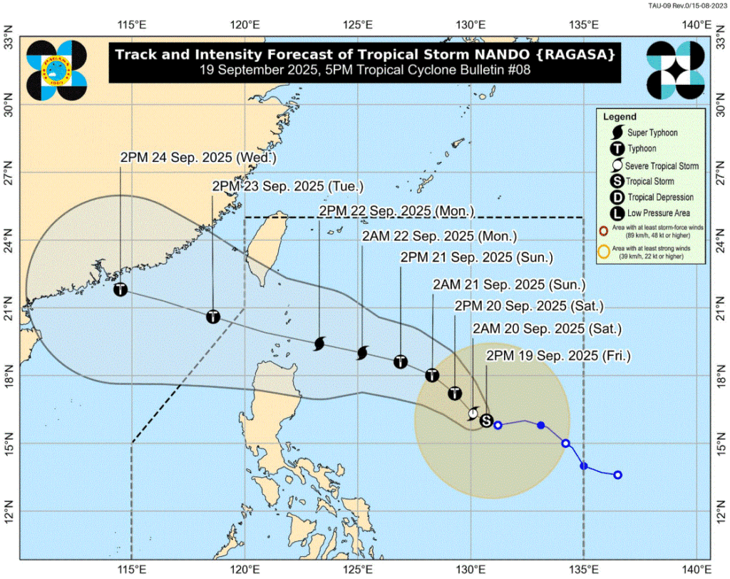
According to the 5 p.m. weather bulletin, the center of Nando was last monitored 905 kilometers east of Central Luzon. It has maximum sustained winds of 85 kilometers per hour near the center and gustiness of up to 105 kilometers per hour.
It is moving northwestward at 10 kilometers per hour.
PAGASA said that the tropical storm will continue to intensify while over the Philippine Sea.
“It may reach typhoon category tomorrow and super typhoon by Monday before its close approach to Babuyan Islands,” the state weather bureau said.
PAGASA added that Nando may pass close or may make landfall over Babuyan Islands between Monday afternoon, September 22 and early morning of Tuesday, September 23.
“Nando may enhance the Southwest Monsoon as it approaches the landmass. Wind Signal No. 1 will be hoisted over Northern Luzon tomorrow (20 September) morning,” the state meteorologists said.
The Southwest Monsoon or Habagat may bring cloudy skies with scattered rains and thunderstorms over Catanduanes, Albay, Sorsogon, Masbate, Northern Samar, and Eastern Samar.
Likewise, the Habagat will also bring partly cloudy to cloudy skies with isolated rain showers or thunderstorms over Metro Manila, Ilocos Region, Cordillera Administrative Region, CALABARZON, MIMAROPA, the rest of Visayas, the rest of Bicol Region, Zambales, and Bataan.
Further, localized thunderstorms may bring partly cloudy to cloudy skies with isolated rain showers or thunderstorms to the rest of the country. —Vince Angelo Ferreras/LDF, GMA Integrated News


