

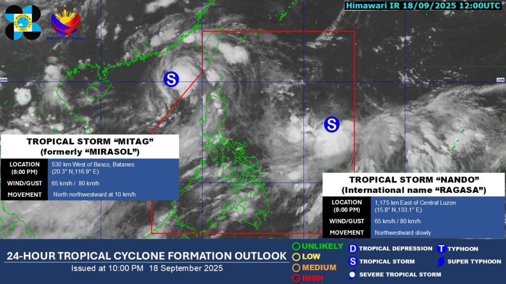
Tropical Depression Nando has intensified into a tropical storm, the state weather bureau PAGASA said on Thursday evening.
As of 8 p.m., Nando was monitored 1,175 kilometers east of Central Luzon. It has maximum sustained winds of 65 kilometers per hour and gustiness of up to 80 kilometers per hour.
It was moving northwestward slowly, said PAGASA.
State meteorologists said that Nando is less likely to directly affect the local weather in the next 48 hours. They added that the onset of heavy rains due to the Southwest Monsoon and the tropical storm is possible by Sunday, September 21 or Monday, September 22.

The state weather bureau reiterated that Nando may potentially enhance the Southwest Monsoon as it approaches landmass, and Tropical Cyclone Wind Signal No. 1 may be hoisted over northern Luzon by Saturday.
PAGASA is also not ruling out the possibility of Nando developing into a super typhoon.
“On the forecast track, the center of Nando may pass close or may make landfall over Babuyan Islands from Monday (September 22) afternoon until Tuesday (September 23) morning. It may exit the Philippine Area of Responsibility by Tuesday afternoon or evening,” PAGASA said in its 11 p.m. bulletin. —Vince Angelo Ferreras/VBL, GMA Integrated News


